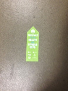
 From the garage's ground level, these little green arrows light the way. (Sorry for the blurry-ness) From the garage's ground level, these little green arrows light the way. (Sorry for the blurry-ness) This post is part two in a three-part series on the 2014 Kansas City Half Marathon. Part two covers the event expo, including packet pick-up. Other posts in this series include...
Expo & Packet Pick-Up Packet pick-up is required pre-race (aka NO race-day packet pick-up). Packet pick-up, same as last year, is located at the event expo, at the Sheraton Kansas City at Crown Center, 2323 McGee Street (Exhibit Hall A). The following are the available pick-up times...
For those that have been to the expo for Hospital Hill, this is the same location and Exhibit Hall (but bigger expo!). You can park at the Crown Center lots, but you'll incur the garage's $5 wrath. Though spots are few and far between at the Sheraton's lot, stalking expo goers for a spot is worth the $5 saved (which is $5 earned!). Just be sure to get your parking stamp validated at the expo (more on that in a second). Once parked, take the elevators or stairs to the ground level. Once there, little green arrows will show the way to the Exhibit Hall. Just follow the green arrows! 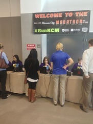 Look at these helpful receipt-printing volunteers! Look at these helpful receipt-printing volunteers! In the week prior to expo time, event organizers sent out emails with confirmation emails of participants' registration. This email is needed for your actual packet pick-up. If you didn't print it off, fret-not! Just outside the exhibit hall is a row of tables with really awesome volunteers to help ease your confirmation-less woes! Just give them your name, and they'll print off a receipt with your confirmation information. Now that that jazz is taken care of, get your parking validated! Right at the opening of the exhibit hall, there's a table specifically for validation. Just give them the parking ticket from Sheraton's garage, and a quick stamp will save you your $5. For 2013 athletes, this table is in pretty much the same location as last year. Now to take care of the last bits of business, grab your packet! These are located at the very back of the exhibit hall. Presumably, this is so you're required to hit the exhibitor tables no matter what, but I like to wait for that table stroll until after my packet is in-hand. Like last year, these are organized by bib number, NOT by last name (hence the required confirmation email). 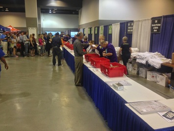 The relay tables were nearly empty. Half-marathon? Not so much. The relay tables were nearly empty. Half-marathon? Not so much. If you're a late registerer, you're all the way to the right. Next from right are the kiddy runners, relayers (black signs), then half-marathoners (green signs), and finally full marathoners nearly all the way to the left of the back wall (blue signs). Upon my arrival, nearly right at 3pm on the first expo day, the half-marathon tables were packed. This is always going to be hit-or-miss, but usually the busiest times for packet pick-up are right at the start, right at the end, or during natural breaks in the day (such as around the lunch our, or at rush hour time). Plan accordingly
Now you can hit the actual expo part of the expo! Various vendors showcase at the expo -- about the same as Hospital Hill (this year at HH, I picked up a Fitletic number holder on the cheap). UltraMax Sports, the Running Well Store, and KC Running Company store are just a few of the local vendors. Take your time, and appreciate the work of all the exhibitors that took their time to come on out! I believe that's about it. You got your packet, your goodies, go home and start carb-ing up!! Until then, keep R/B/S-ing. -tds ~~__o _-/<,_ @/ @
0 Comments
This post is part one in a three-part series on the 2014 Kansas City Half Marathon. Part one covers the course preview, including Virtual Run feature. Other posts in this series include...
If you're looking for a great run that tours the city's best, this is it. With either the full or half-marathon iterations, the Waddell & Reed Kansas City Marathon Weekend gives participants a tour on-foot of the neighborhoods and landmarks that puts KC on the map. With the half-marathon alone, runners get to trot through the Power & Lights District, Crossroads Arts District, Crown Center, the World War II Memorial, Old Westport, the Country Club Plaza, Nelson-Atkins Art Museum and Frank A. Theis Park, Hyde Park, Beacon Hill, and the 18th & Vine Jazz District. All in the half-marathon! The full marathon travels further south, including parts of Loose Park, Ward Parkway, Mission Hills, Historic Brookside, and UMKC Campus central to Kauffman Legacy Lake. And, of course, all runners get a healthy dose of the Paris-of-the-Midwest's many fountains. And yes, there will be barbecue/BBQ afterwards. On to the course preview! Course Preview The Google Maps route can be found HERE. 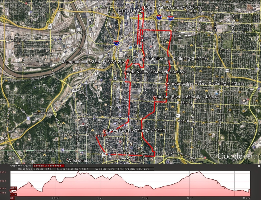 Image Credit: Google Earth Intro For this course preview specifically, the half-marathon distance will be covered. Maps for the full marathon course, full marathon relay course, and even 5k course can be found using the links right here, or at the marathon's official website, which is linked at the top of the page. Of important note, this year's course has been altered due to construction downtown. The changes are minor, but if you're used to running the 2013-and-previous route, you'd be tempted to take a wrong turn. Beyond the downtown sections, the southern half of the full and half courses are pretty much the same as before. Also of note, and I've noticed this in the past, though the "shortest route around the course" method produces something lik 13.1 miles (for ex., the full marathon is actually a Boston Qualifier), this course -- out of all of the half-marathons I've done just this year alone -- is the furthest from 13.1 on-foot. By the map, this course runs 13.41 miles. On foot (last year), the course ran closer to 13.5. Be expecting that going in. The following stats also reflect the "by-the-map" metrics. Course Basics/Metrics Here are the basics for the 2014 half-marathon route...
There are 7 climbs on-route that are "rated" (I use my own rating system for running climbs), which basically means seven climbs that are over 30 feet of climbing. Here's how they stack up.
Virtual Run (All Images credited to Google Earth Street View) Again, this covers the half-marathon. The full marathon, including marathon relay, has the same northern half as the half-marathon. The only difference is further runs along the Plaza and south on Ward Parkway. Once making the way back up, the full marathon route meets back up with the half-marathon route. Click on any of the links provided above for the full marathon map. For the 5k, the route is completely different. A link for that map is provided above as well. Start to Mile 1.00 -- All routes start in the same location (although, the 5k starts later in the morning), just North of Crown Center Plaza, on Grand, in front of Washington Square Park. 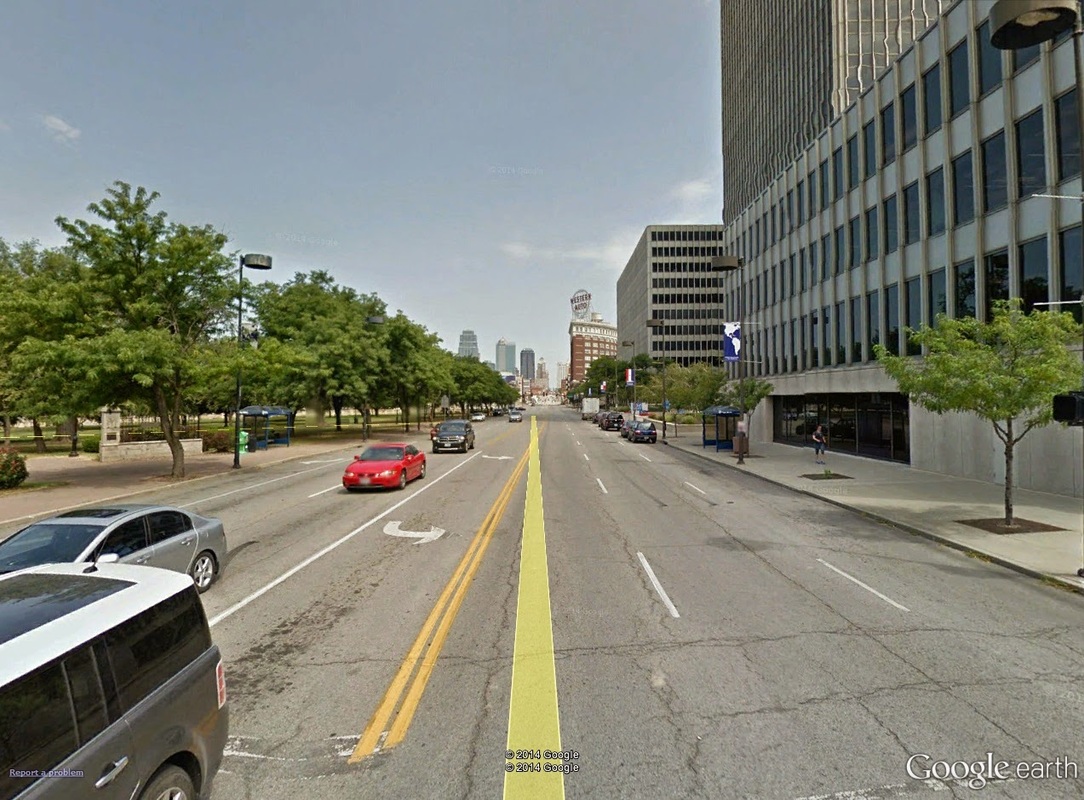 0.0mi: What would be the view from the start line, looking north on Grand towards downtown. Washington Square Park is on the left. The course begins North on Grand Boulevard towards the Power & Lights District. Right ahead of the start chute is the City's main railroad tracks. 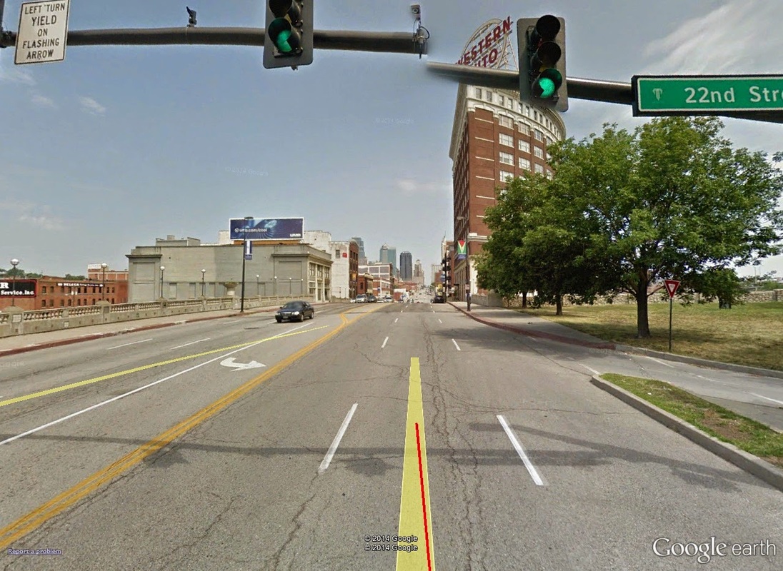 0.25mi: Said bridge. Really climbing begins here, as the bridge has a natural bow to it. But just beyond the bridge you can see how the road picks up. Once that bridge is crossed, the very first climb begins ("Grand to PNL"), a mile-long, gradual, 2.3% grade ascent up to the Power & Lights District and around the North side of the Sprint Center, where it peaks out at 13th & Oak, about 1 mile in to the race. 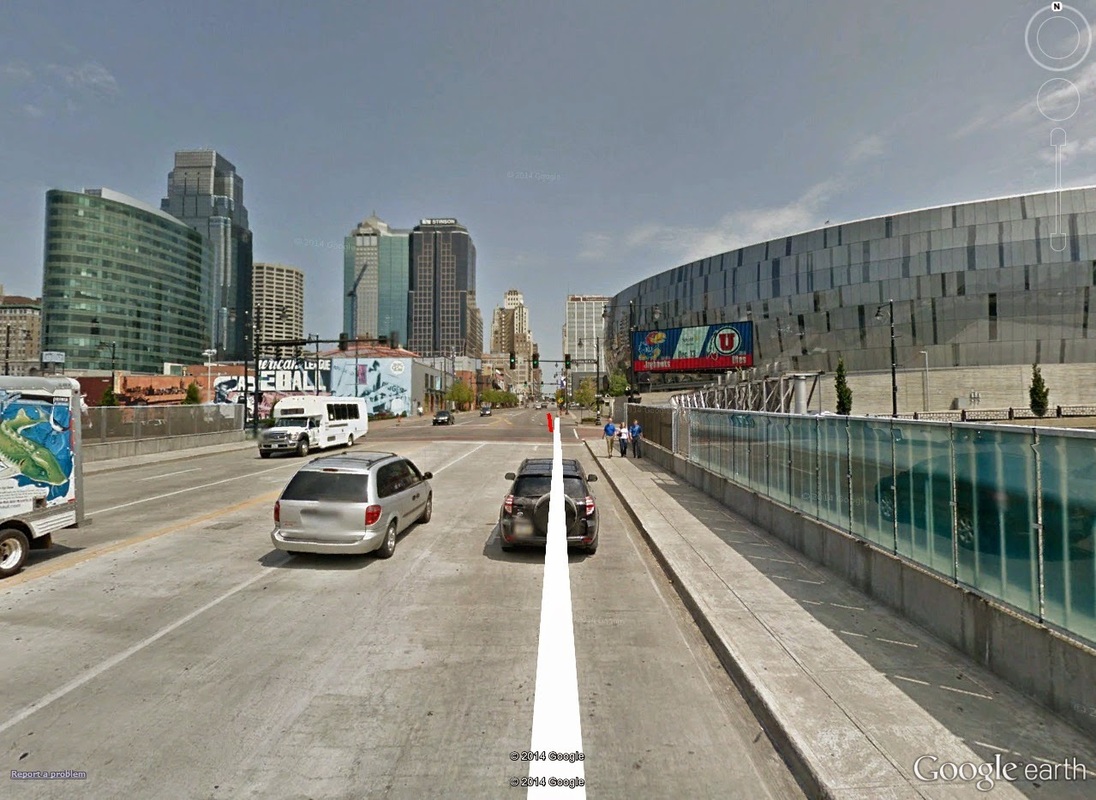 0.70mi: Nearing the top of the Grand to PNL climb. The 1-mile marker would be on the opposite side of the Sprint Center, caddy-corner from this view. Miles 1.00 to 3 -- Of equal descent is the run South on Oak back towards Crown Center, passing first through the Crossroads Arts District centered at Oak and 18th Street. Once the bridge over the same train tracks is crossed (at Oak and about 20th), the second major climb begins up the famed Hospital Hill. 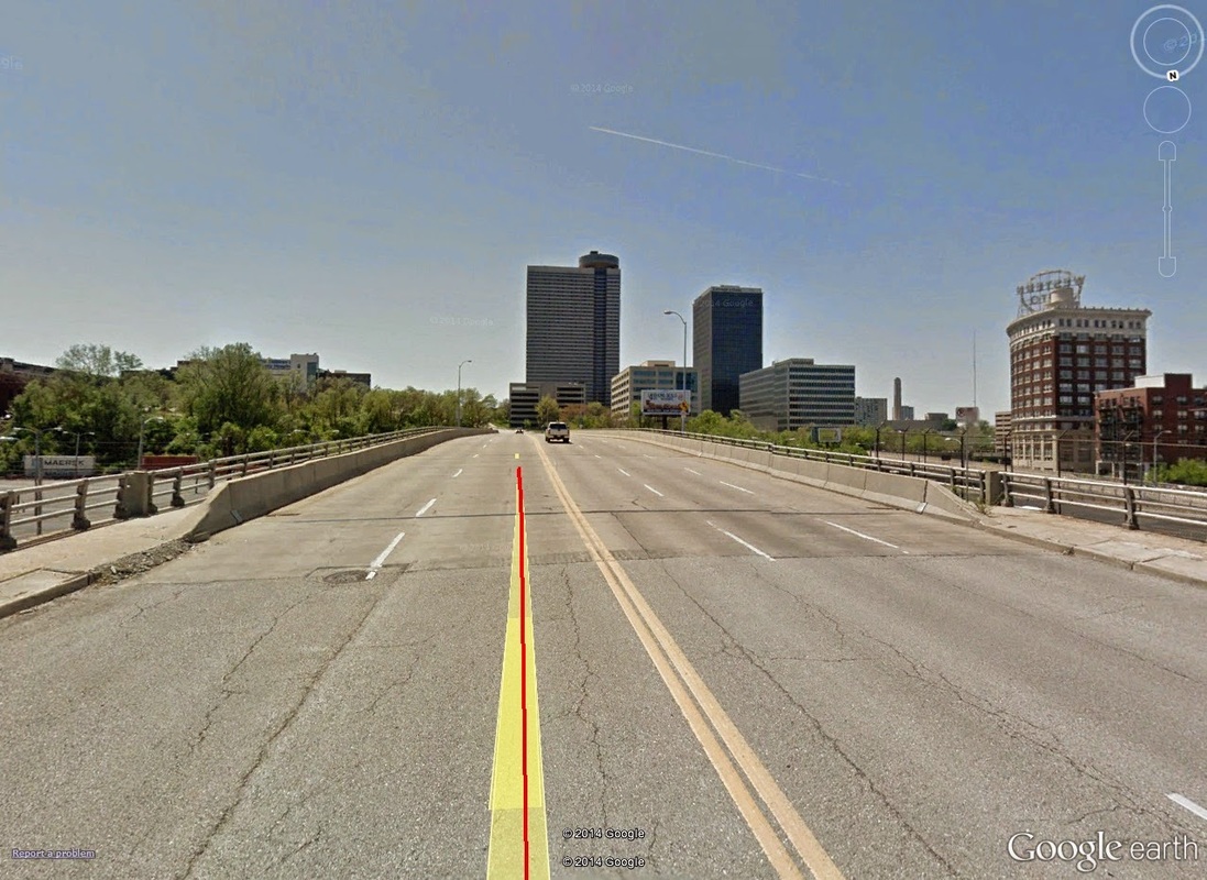 1.75mi: Just past the Crossroads Arts District (to the East), the next climb begins, which actually is Hospital Hill. Although this section technically runs up over Hospital Hill, the alternate entrance on to the hill cuts down the overall climb -- usually the climb begins out of Crown Center and on to Pershing Road. Either way the hill remains steep, and is bound to wear ambitious runners a bit thin. Hospital Hill peaks at Longfellow Park, after over half a mile and 104 feet of climbing. A right-hand turn pushes runners West along 27th Street, eventually spilling on to Memorial Drive, and another famed climb, Memorial Hill. This route puts runners already halfway up the climb, which normally also begins down on Pershing Road. The 3-mile marker hits at the entrance to Liberty Memorial Park. Take a deep breath and enjoy the view -- at this point on course, the sun is just now showing its colors, and with the panorama of downtown Kansas City behind the Liberty Memorial, provides an absolutely picture-perfect backdrop. 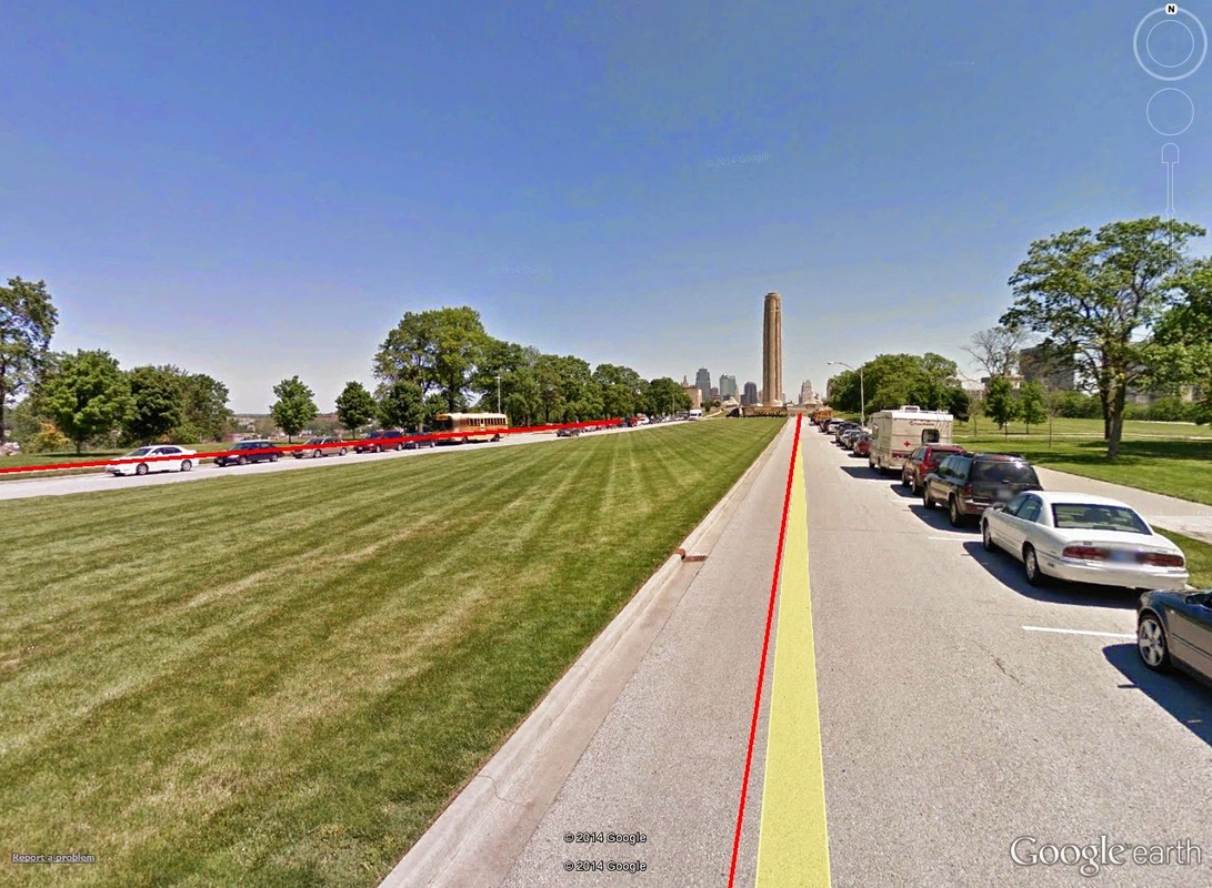 2.95mi: Mile marker 3 comes up right as runners enter Liberty Memorial Mall. Included will be Liberty Memorial, and a hill-top view of the Kansas City Skyline, just in time for the colors of the morning. Miles 3 to 5 -- Liberty Memorial Park provides one of the few truly flat spots on course. Half and full marathon participants will run the entirety of Liberty Memorial Drive, a 0.40-mile flat trek towards and then away from Liberty Memorial. On exit from the park, the climb up South on Wyandotte Street past Penn Valley Park provides the next major climb. At first only 2.5% grade, the latter half of this 0.34-mile climb pitches upwards at a consistent 9.5% grade. Though short, this hill sees many walkers. The descent down Penn Valley Hill, off of Wyandotte, and on to Eastbound 31st Street sees mile marker 4 at Main Street. 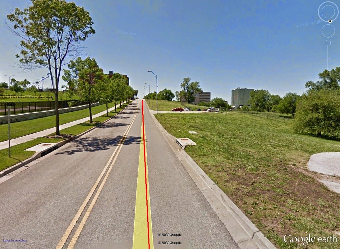 3.6mi: The short-yet-nasty climb up Wyandotte St. It's nastier coming from the opposite side (as you do in the Hospital Hill 10k/HM), but still steep from the North, too. Penn Valley Park is on the right. At 31st, runners turn right heading South on Main Street, which provides a fast and easy descent for three-quarters of a mile. Main Street pitches back upwards at 27th, however, before hitting mile marker 5 and turning right on to Westport Road. Miles 5 to 8 -- Half- and full-marathon'ers descend on to Westport Road around mile 5. The 'descend on' is short-lived, as not long after the turn the next climb in-to and out-of Old Westport begins (for those familiar with Westport, runners enter in through the Northeast, from the side where the Riot Room and The Foundry are). The 2.7% and 0.34-mile short climb out of Westport ends as runners turn West on to 43rd Street. 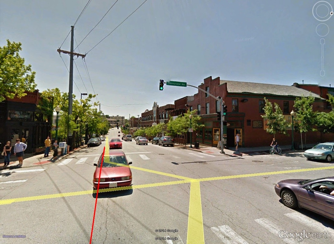 5.25mi: The center of Westport, of Westport Road and Pennsylvania. Off in the distance you can see the next climb out of Old Westport. Things speed up at 43rd Westbound, as the route descends, seemingly in preparation for the last set of long climbs. A turn left off of 43rd on to Southeast Roanoke Parkway drops participants in to the Western edges of historic Country Club Plaza along 47th/Emanuel Cleaver II Boulevard. 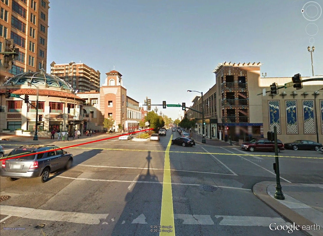 5.95mi: Just short of the 6-mile marker, runners will foot over the roads of beautiful Country Club Plaza. Once again, enjoy the scenery, as the route flattens out all the way through to the front lawn of the Nelson-Atkins Museum of Art (with Frank A. Theis Park opposite). 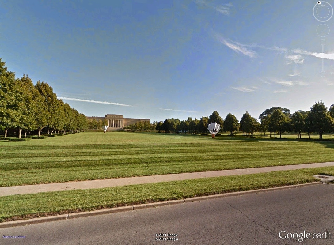 6.5mi: The Nelson-Atkins' famous front sculpture gardens make an appearance. Just short of mile-marker 8, half-marathoners will turn off of Emanuel Cleaver II Boulevard on to Troost. Marathoners will stay straight on Cleaver II until turning south on The Paseo. Given the late-race location, I have seen many-a-half-marathoners miss the turn and continue straight (and many marathoners make the turn instead of going straight). Half-marathoners turn left on to Troost! Full marathoners keep straight until The Paseo! 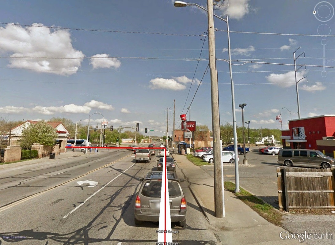 8.0mi: Emanuel Cleaver II looking east. This is where the route splits: the half-marathon route (in red) turns right at the traffic lights on to Northbound Troost, while the full marathoners continue on straight through the lights until reaching The Paseo. Miles 8 to 10.50 -- This entire section - all 2.5 miles of it - is made up of hill. Off of Emanuel Cleaver II Boulevard, runners hit a quick road-change combination: North on Troost, followed by a next-left going West on Brush Creek Boulevard, and an immediate right on to Gillam Road going North and Northwest. This combination marks the beginning of the Harrison Boulevard Climb, a massive 1.82-mile ascent up 137 feet -- not steep, but quite long. Along the ascent, runners are privy to miles of parkway, including Gillam Park and -- once Gillam forks eastward on to Harrison Parkway -- Hyde Park. 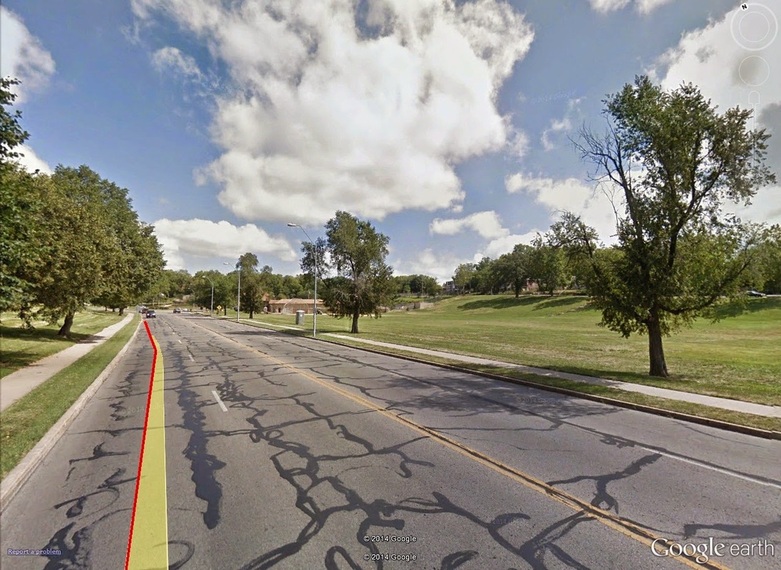 9.0mi: Gillham park on the right, and Hyde Park just past the building ahead. This is about halfway up the Gillham-Harrison climb, which though shallow, runs long. The Harrison Parkway climb peaks at the intersection of Harrison and Armour, although, in reality, this entire section is really one longer hill. The second half of the incline begins nearly immediately once runners are turned Eastward on Armour, followed by a left-hand turn heading north on The Paseo. If history proves correct, for me at least, it's around here that attention wanes, legs cramp, and motivation suffers. But at the top of this Gillam-to-Harrison-to-Armour-to-Paseo climb, only 2.5 miles remain -- all of which are downhill. Mile 10.50 to Finish -- 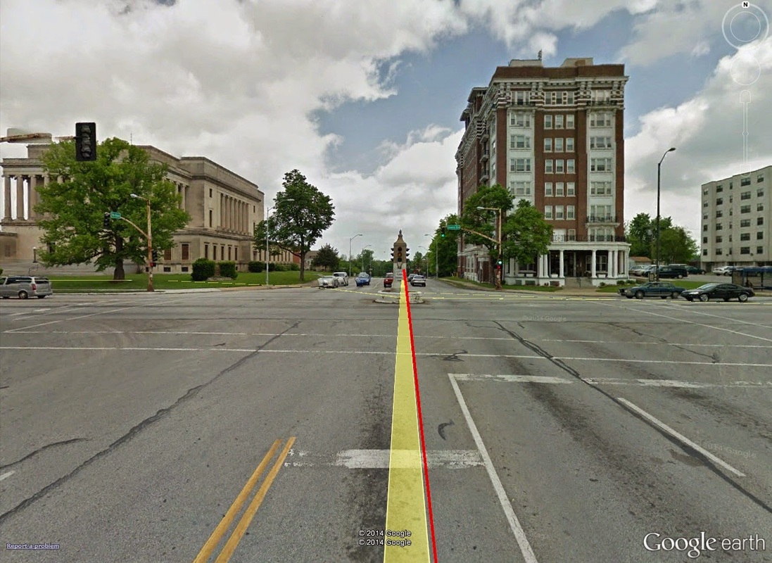 10.5mi: At The Paseo and Linwood Boulevard (I love that stoplight!): the top of The Paseo climb, which signals the last of significant climbs on-route for the half-marathon. The trek North on The Paseo brings about all of the glory you would expect from the Paseo (hah-hah). Even though the remaining miles of the Paseo are largely downhill, this stretch feels immeasurably long. However, the payoff begins only 2km later, at only 1 mile to go, when the route turns West on to 18th, edging along the Western corner of the historic 18th & Vine Jazz District. Under the 71-highway bridge, the final miles begin to trickle down, and the motivation begins to inch upwards. 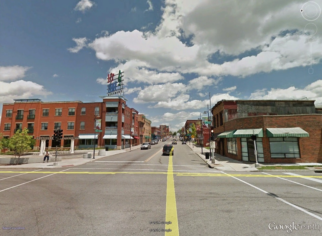 12.0mi: The route turns West off of the Paseo on to 18th Street. This view is on 18th Street, with The Paseo crossing from left to right. If you were to look left as your were turning West on to 18th Street from The Paseo, this would be your view: The 18th & Vine District -- home to some of the best jazz in history. A turn left at Grand, runners will find the final quarter-mile laid out before them. Soak in the cheers and final painful steps. Cross the line, collect your hardware, and revel in your accomplishment. ...and think of those poor saps miles that are only halfway finished. 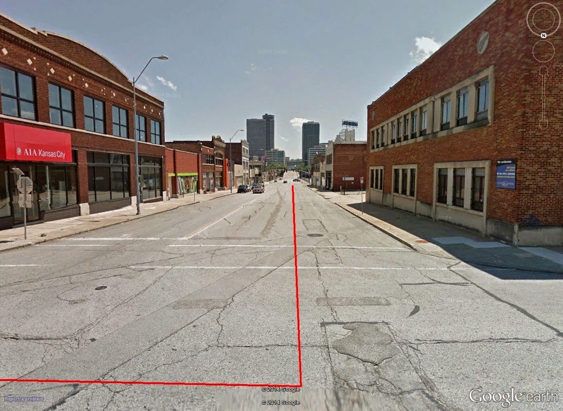 13.0mi: Looking south on Grand towards Crown Center (18th Street to the left). The tall building off in the distance on the left (with the circular top) is the Sheraton Crown Center. The finish itself is right back where you started. It is oh-so-slightly uphill, particularly at the bridge crossing. Information on Expo & Packet Pick-Up to follow in Part II on the afternoon of 10/16. Once the race is complete, a Part III will be posted the following week.
Until then, keep R/B/S-ing. -tds ~~__o _-/<,_ @/ @ |
