|
2015 Westport St. Patrick's Day 4-Mile Saturday, March 14th @ 10:00am Westport, Kansas City, Missouri
New this year, is the St. Patrick's Day 4-Mile's inclusion in the KC Sweet 16 4-mile race series; also included are the CCVI Trolley Run, Ward Parkway Four on the 4th, and the KC Zoo Run. All races in the series have been running event staples in the area for quite some time, so it only made perfect sense to round them all up together. The Westport St. Patrick's Day 4-Mile is the first in the series, always held in-line with the Westport St. Patrick's Day parade. Packet Pick-Up Friday, March 13th, 10:30am-6:00pm Gary Gribble's Running Sports Ward Parkway Shopping Center 8600 Ward Parkway Kansas City, MO Packet pick-up is also available on race-day at Manor Square lobby (near the start line). Race Day Parking Participants and spectators are urged not to park along the race route (see below), as vehicles may be towed. Near the start line (and surrounding areas), all Westport parking areas are fair-game. The start line is near the corner of Westport Road and Mill Street (with the race route heading west), so parking at any of the lots along Westport Road to the east of there seem to be the best bet. Given the location of the start line (as well as the start time being near business hours), I would avoid the World Market parking lot (they may even have it blocked off), although don't take my word for it -- for the Westport Santa Dash 5k in December, may seemed to find parking there perfectly suitable. However, parking in the lot just east of World Market, on the east side of Mill Street, is a safe bet, as well as the spots along Mill Street to the south of the start line. The approximate location of the start line is shown in the following map... NEW SECTION! -- Race Amenities
Course Preview (with Virtual Run) Introduction & Route Basics 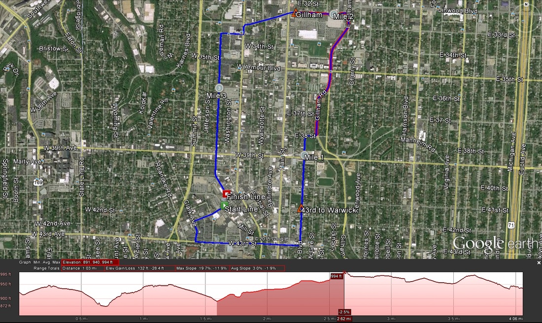 A Google Earth view of the route. I highlighted the second major climb on-route to show it's false-flat near the top. Though I didn't participate last year, I understand the route is the same (and was the same in 2013 as well). There are a few climbs on-route, two significant of note. Here are the basics...
Climbs Two on-route, although there is a third smaller climb near the start line. The second major climb is sorta beastly.
Virtual Run (all images credit to Google Earth Street View unless otherwise noted) 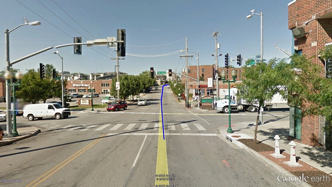 Mile 0.00: Approximate location of the start line. The start takes off from the intersection of Westport Road at Mill Street, in front of World Market and The Landing shopping center (where Jerusalem cafe is). The route heads west on Westport Road. The opening meters are actually a down-hill kick -- a nice way to grab some quick momentum -- followed immediately by an up-hill. The first climb isn't a "significant one," per se (i.e. not, covered in the climbs descriptions above), but it is noticeable. 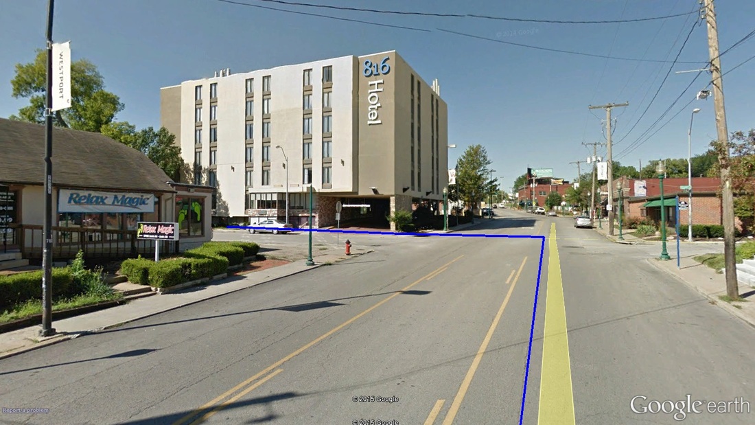 Mile 0.20: The turn off of Westport Road and on to Clark Avenue. Nearing the top of the opening mini-climb, runners come off of Westport Road and left on to south-bound Clark Avenue. Just after turning on to Clark, climbing stops and a HUGE downhill begins. Keep in mind: what elevation you lose, you will have to gain back. 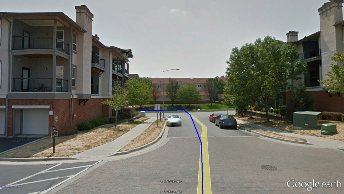 Mile 0.30: The quick turn off Clark and on to West 43rd Avenue. Almost as immediately as the turn on to Clark, runners take another left off of Clark and on to West 43rd. The drop continues, however, all the way to Broadway. 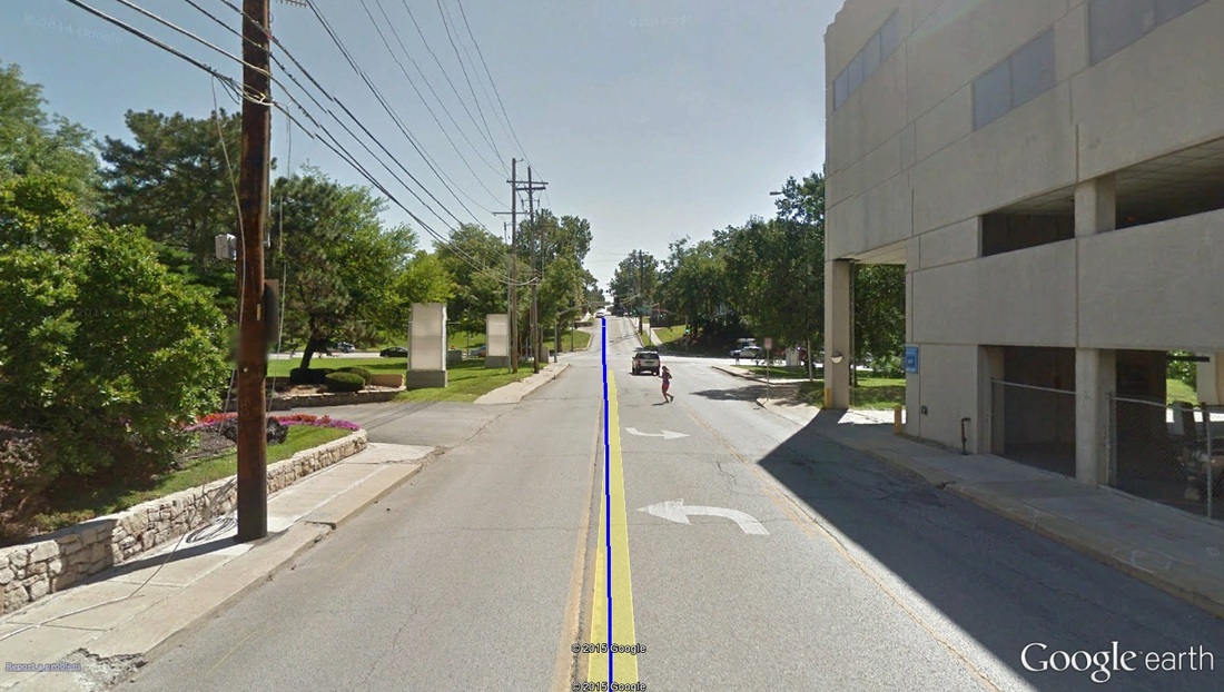 Mile 0.70: The base of climb 1 (43rd to Warwick). Google Earth even caught a runner enjoying this stretch as well...hello, runner! About halfway along the West 43rd stretch, nearing Broadway Boulevard, the drop stops and abruptly makes up all the elevation lost -- about 75 feet in the span of half a mile. 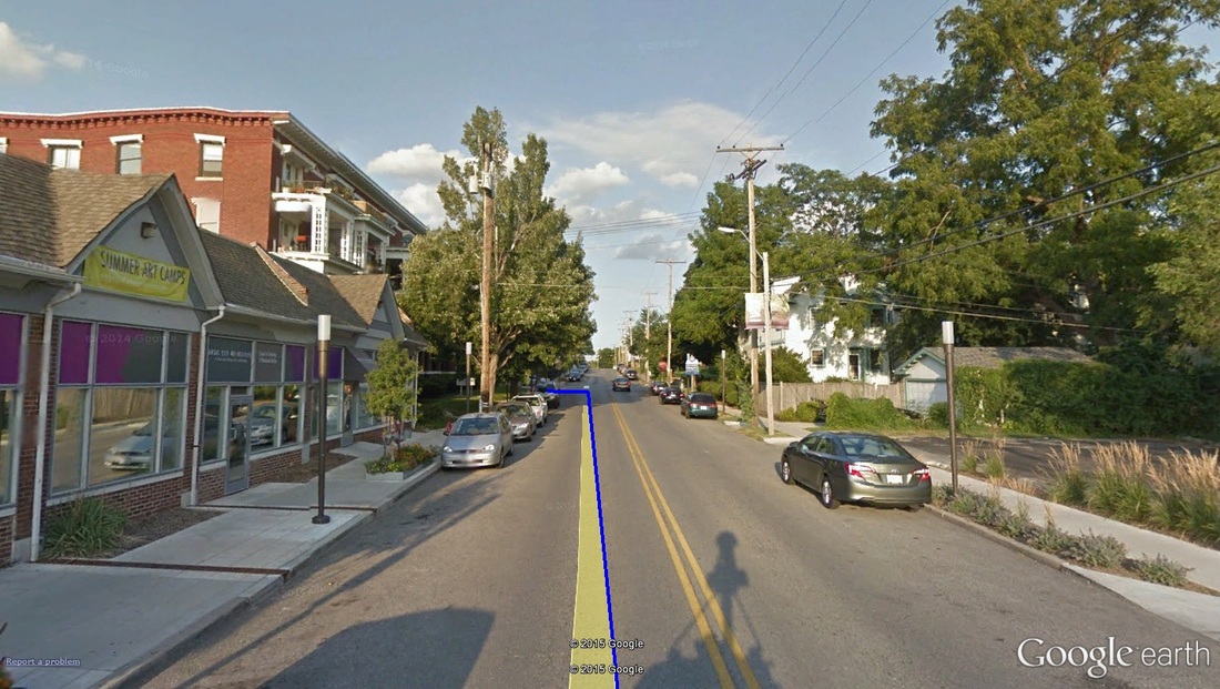 Mile 0.90: The turn off of West 43rd and on to Warwick. The climbing continues, however. At nearly 1 mile in, and halfway up the 43rd-to-Warwick climb, runners take another left off of West 43rd, now heading north, on Warwick Boulevard. Mile marker 1 is just beyond the turn, and nearly to the top of the first climb. At about 1.1 miles, the first climb tops out, and runners begin another descent, almost-but-not-quite as steep as the last descent. 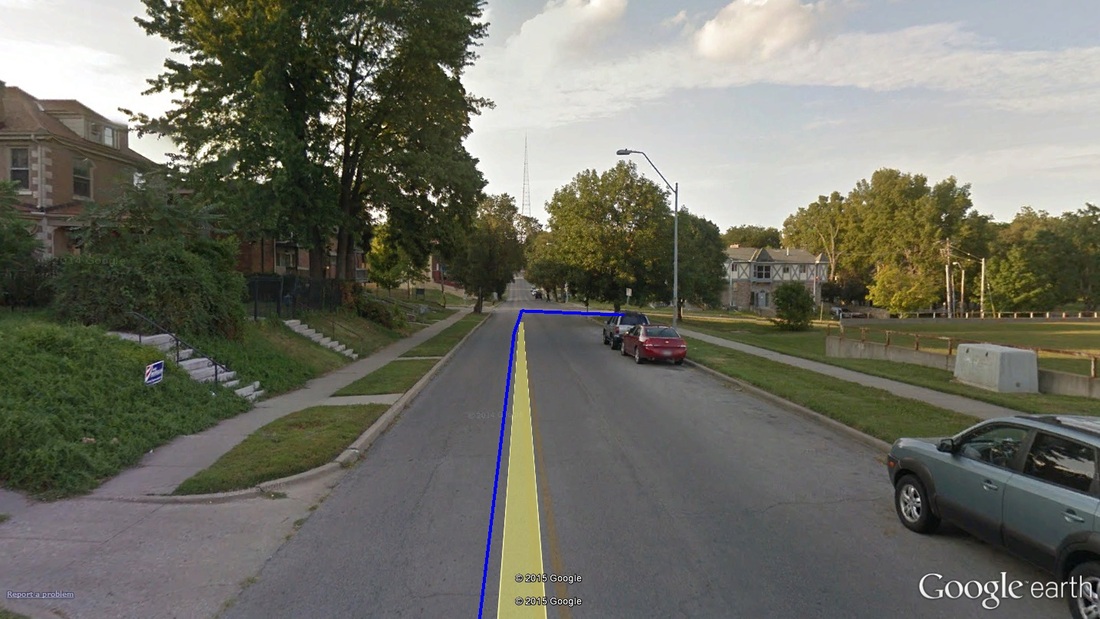 Mile 1.50: A quick turn off of Warwick Boulevard and on to East 38th Street... 1.5 miles in, take a right on to East 38th Street heading east. The road continues to drop. Take advantage of this stretch (along 38th) as much as possible! 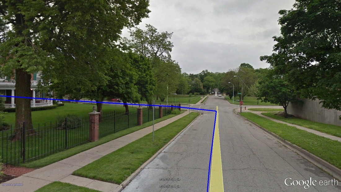 Mile 1.60: ...and then a quick turn off of East 38th and on to Gillham Road heading north. Not a tenth of a mile later, runners turn off of East 38th and on to Gillham Road. This turn marks the end of the descent and the start of the second climb. Those familiar with running north on Gillham Road (i.e. KC Marathon) will know, it climbs nearly the entire way, and wears on the legs quite a bit. It's not steep, but just steep enough to challenge. For the St. Patrick's Day route, this stretch of Gillham will climb for nearly a mile at 2.5% average grade (but nearly 8% at some points), and up just over 100ft. 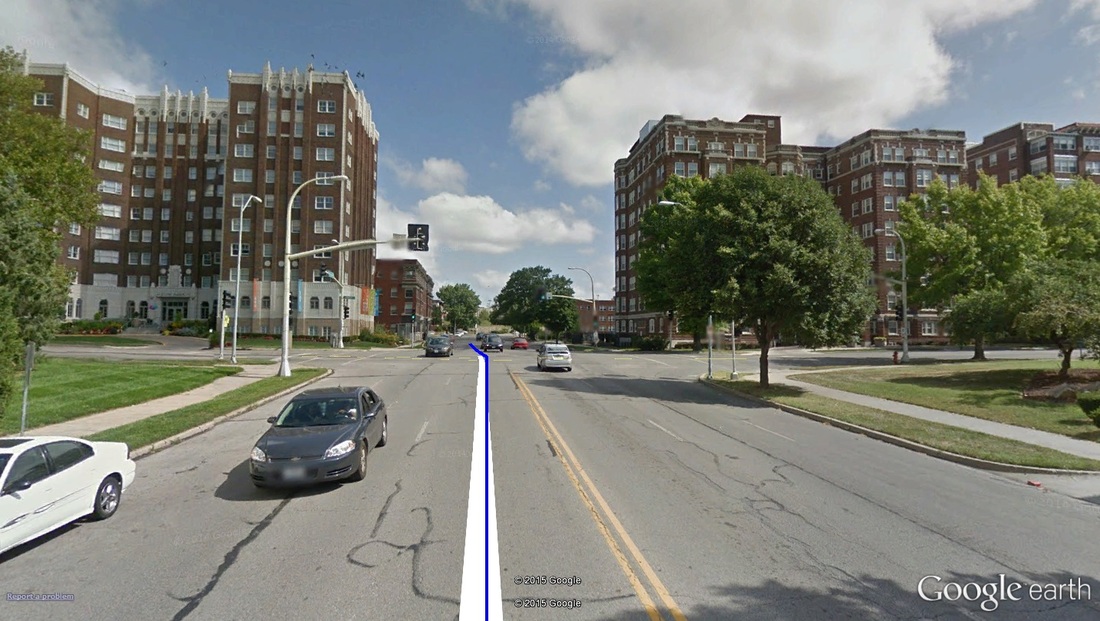 Mile 2.00: The climb up Gillham continues through Armour Boulevard (pictured). Mile marker 2 should be about here. 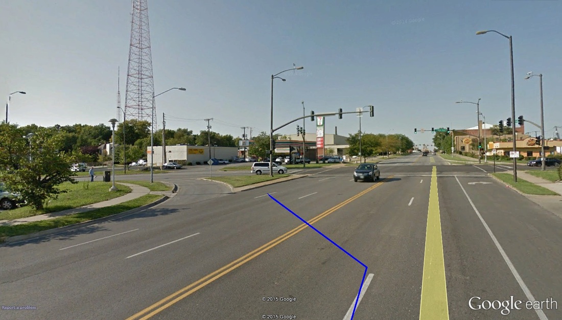 Mile 2.30: Turning off of Gillham and on to Linwood. This also [pretty much] marks the end of the second of two major climbs on-route. At about 2.3 miles in -- 1.7 to go -- runners take a left off of Gillham Road and on to Linwood Boulevard heading west. For me, this would mark a very significant point in the race: all climbs on this route happen in the first 2.5 miles. Coming off of Gillham, you the most significant pitches of the Gillham Road climb have been conquered. There are still a few feet to battle, from here to the finish, but for the most part they are all shallow bits. However, with still over a mile and a half to go, if you can recover from the climbs, you have plenty of time to kick hard to the finish. 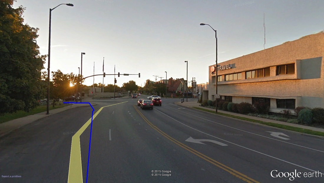 Mile 2.90: Quick left-hand turn off of Linwood and on to Broadway... 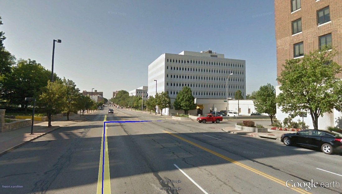 Mile 3.00: ...followed immediately by a right turn off of Broadway and on to West 43rd Street. After about half a mile running on Linwood, runners will take a left heading south on Broadway, followed almost immediately (about 100 meters later) with a right-hand turn on to West 43rd Street. The turn on to 43rd Street should come with it the 3rd mile-marker. 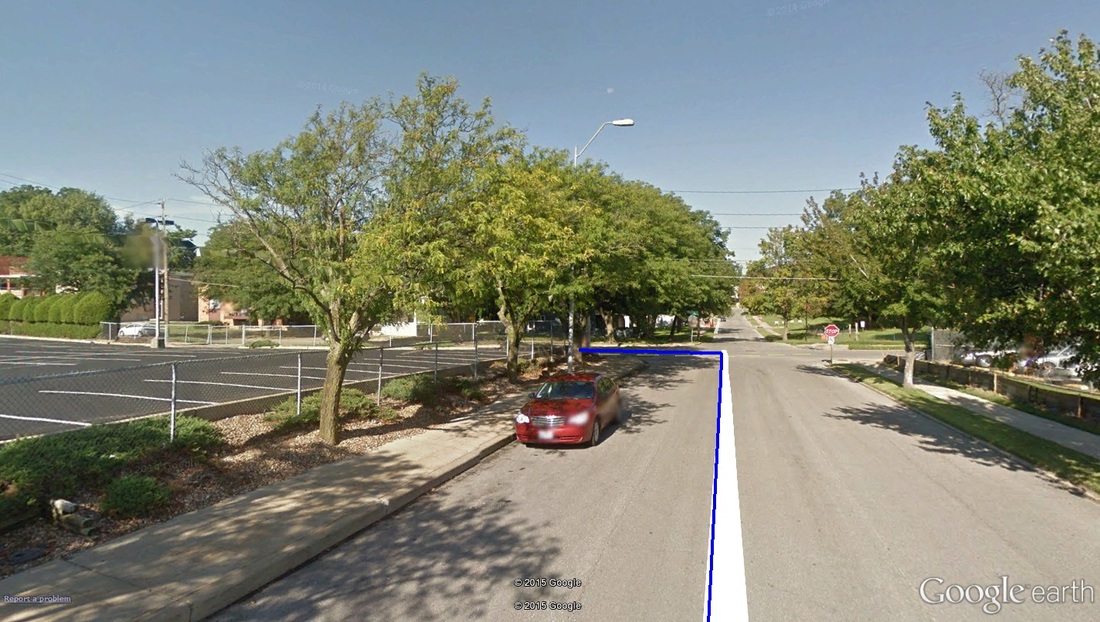 Mile 3.10: A left turn from 43rd to Pennsylvania Avenue south. Just past mile marker 3, runners take a left off of 43rd Street and on to the longest single-road stretch on the course, southbound Pennsylvania Avenue. About 3.4 miles in (1k to go), there is a slight up-hill on Pennsylvania -- about as steep and long as the climb just off the start line -- that will only cause headache if your legs are feeling sloppy. Let's face it -- at this late a point in any race, all up-hills feel mountainous. 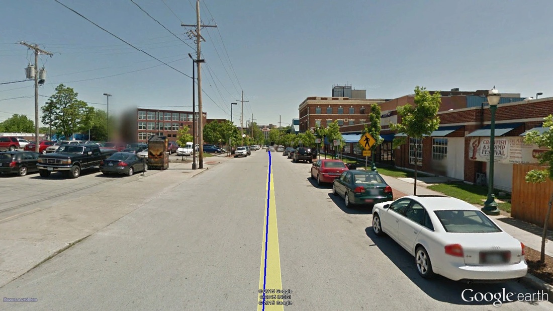 Mile 3.90: The final meters, the Beaumont club on the right of the image. From 3.6 miles on, the road is all downhill. Enjoy the quick finish! The finish line sits in front of Manor Square (just short of Kelly's), around the corner from the start line. Grab a medal and a water -- you've earned it!
-tds ~~__o _-/<,_ @/ @
0 Comments
Your comment will be posted after it is approved.
Leave a Reply. |
