|
2014 Longview Half -- Saturday, November 15th, 8:00am This event's official webpage can be found HERE. Another new half, this year will certainly be known as the "year of halves" for me: this will be my 7th of 2014. As far as late-autumn races go, this is certainly one of the most popular, and definitely the most popular late-season half-marathon after the Kansas City Half. This event specifically is dedicated solely to the half, and no other distances are offered. I've raced out at Longivew several times, but always on the bike, and on-foot, only on the surrounding trails. It is always an interesting perspective to run along a route you have biked so many times before. Packet Pick-Up
Race-Day Parking Okay, now this one is a bit tricky. I've been to numerous events out at Longview Lake, including at the specific site for this year's start and finish. There's likely to be parking near the start-finish in the grassy area behind the start area, but the only entrance and exit is on-course, so don't expect to get out immediately after finishing if you decide to park here. Instead, I recommend parking in the park area to the North of the start finish line, just East of Raytown Road, off of Longview Road (see map below). There is ample parking here, and although it is quite the walk to the start/finish line, you are guaranteed an easy exit (barring waiting for a break in runners). Really, though, it's just a tough area for parking. And the route in relation to the start/finish sort of "traps you in." Course Preview Intro This route has changed from earlier iterations. I believe earlier in the year the route included more of the Scherer Road climb, all the way east to SW Simpson Road, and didn't include the Raytown Road extension past Scherer. This means less climbing on route, as you are only going up (part) of the High Grove climb once, and then turning around at the top. Before, you went up and down and past the Scherer Road climb, then turned around, and went back up it from the other side again.Virtual Run is featured below for this race, although the pictures may be more few-and-far between. Other than Scherer, the course is straight and flat and straightforward. But more on that later. Route Basics/Metrics 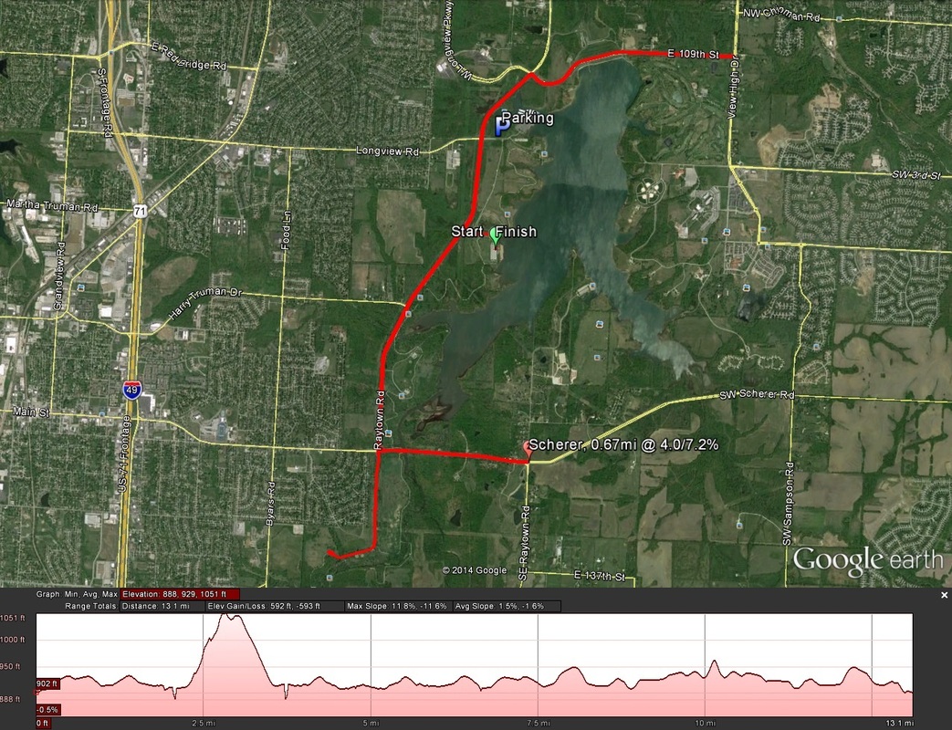 Here are the basics for the 2014 route...
Climbs & King of the Mountain Though you can expect undulation throughout the course (as is so-common for KC Metro area events), there is one significant climb featured on the course. New this year, KC Running Company is featuring a King of the Mountain Competition for the climb on-route. Sitting at just short of a mile, timing mats will be placed at the bottom and top of the High Grove climb (deets below). The fastest 15 men and fastest 15 women for the king of the mountain will be awarded special King of the Mountain (or Queen of the Mountain) plaques. The climb is pretty beastly, up 183 feet at an average of 5% (12% in a few spots), so it will by no means be an easy task. I have climbed this hill several times on the bike during various races (duathlons, mostly), and it's fairly punishing on the bike even (perhaps I will post a video of it on here soon). KC Running Company claims it to be closer to a mile than I have measured and experienced in the past, but it is possible that the timing mats will show up earlier than the true start of the climb, and after the true end of the climb (probably at the turnaround). Here is the information on the climb itself (as opposed to how the timing mats will be situated, which I have no information about)...
Aid Stations Aid stations with water and sports drinks are reportedly to be featured every other mile. At mile the mile 8 aid station, GU energy gel will be available as well (perfect for me, as I've been training with GU this year). Course Description w. Virtual Run Start to 2.00mi: The start line is in the parking lot of one of the many parks that line Longview Lake. This particular park is just off Raytown Road (West side of the lake), on Pittenger Road. The opening miles head out of the park along Pittenger Road to Raytown Road, first heading Southbound. From the start line to Raytown Road is actually uphill a little bit, so be expecting that (only about 30 feet of climbing before leveling out). 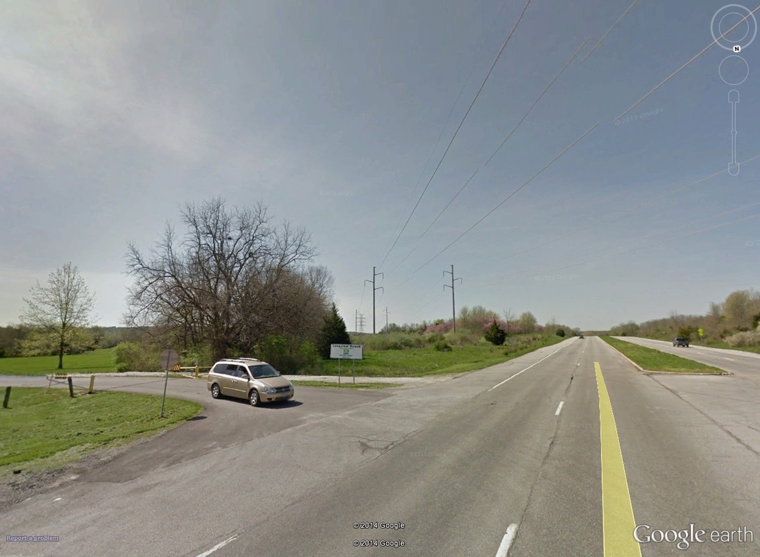 0.10mi: Looking from the North, runners will come off of Pittenger Road (on left) and on to Raytown Road heading South (on right, away from point of view). From there, it is nearly flat. all the way to the first and only significant climb of the day. The scenery also remains the same, with runners heading South (in the Northbound/left lane, by the way), Longview Lake on the left. 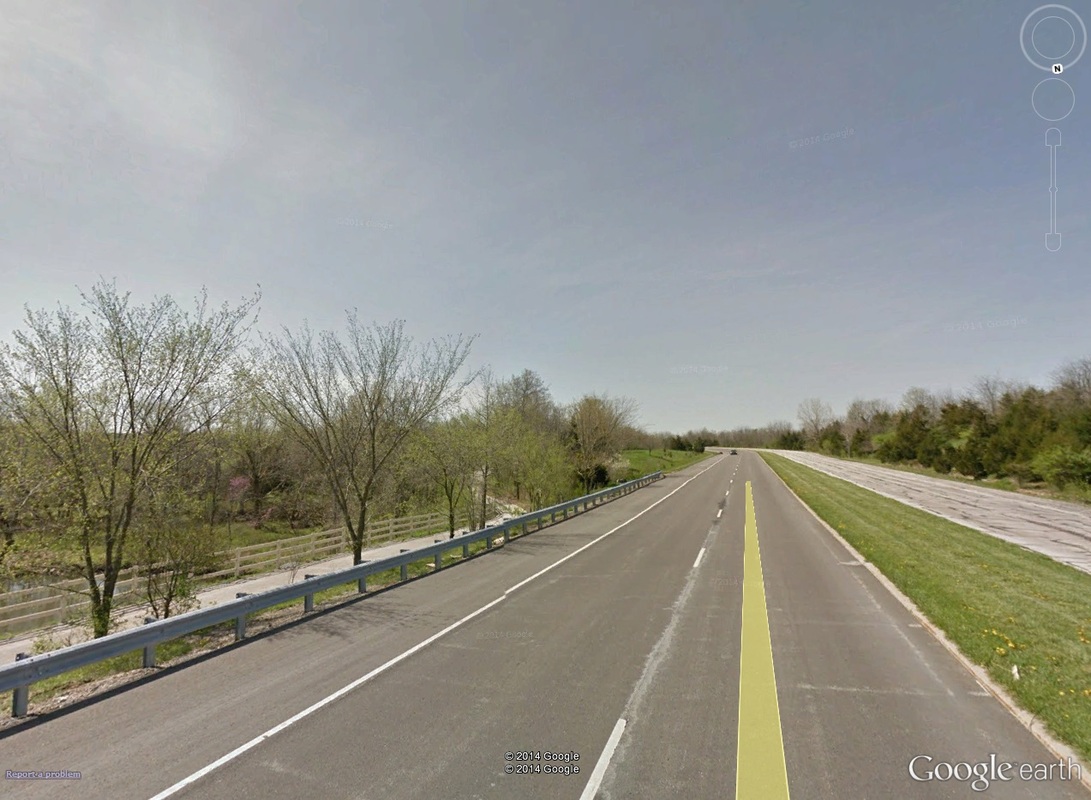 1.00: About where mile marker 1 would be, although it's a bit hard to tell -- such is the view for the majority of the run both Southbound and Northbound on Raytown Rd. Note that runners will be in the Northbound/left lanes when running out from the start line South. 2.00mi to 4.00mi: Just before the 2-mile marker, runners take a left on to High Grove Road. Not long after the turn (and the 2-mile marker), athletes pick up the first and only climb of the day. And it is quite the climb, up nearly 180 feet in only seven-tenths of a mile. This also is the climb that features the new King/Queen of the Mountain competition. 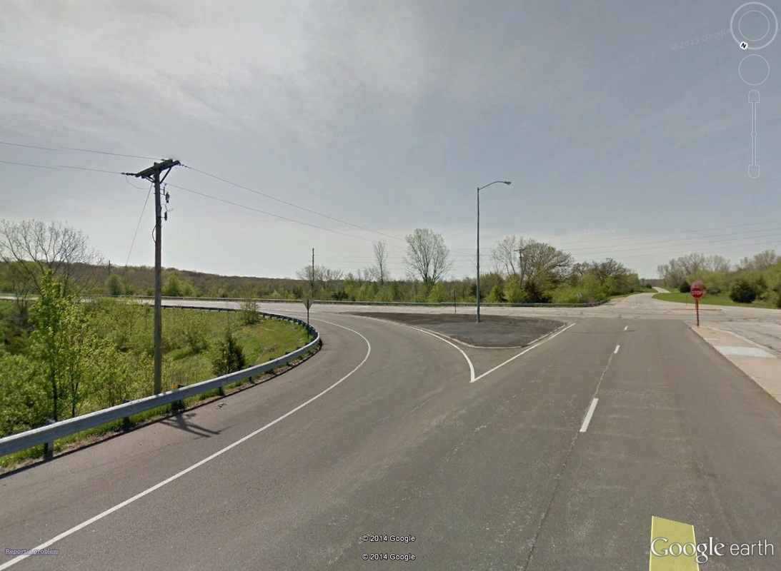 1.90mi: At just under 2 miles, runners take a left off of Raytown Road (using the turn lane in the center of the image here) and on to Eastbound High Grove. 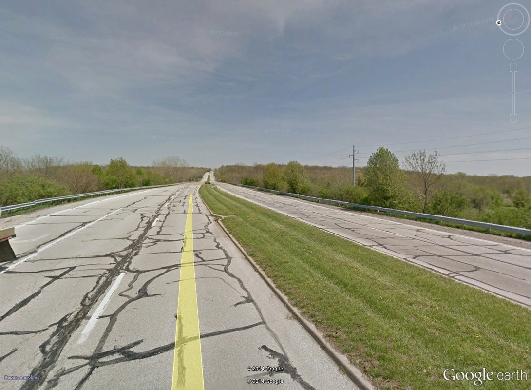 2.00mi: About where the 2-mile marker would be. The High Grove climb can be seen off in the distance. It begins just past the bridge. The King of the Mountain starting mats could be as far back as here, which would account for the nearly-one-mile claim laid by KC Running Company. Continue on High Grove, up the hill, until the turnaround at SE Raytown Road (a different Raytown Road from the one before). Just past the turnaround, you hit 3 miles, and begin the fast descent down High Grove. 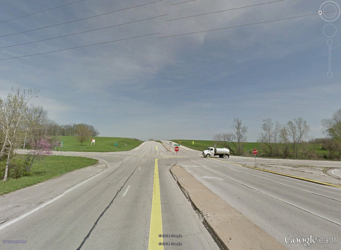 2.90mi: Though High Grove continues to climb, runners will top out at the stop sign pictured here, as they will turn back around (this time to the opposite, Eastbound lane heading West) and head back West on High Grove. The 3-mile marker is about here on the opposite side of the road (after the turnaround). On the approach back to Raytown Road from High Grove, rather than turning back right heading North, runners will turn left going South (I believe it the street changes names to Kurzwell Road, also). Mile marker 4 comes just after the turn on to Kurzwell. 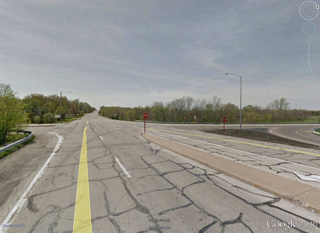 3.90mi: On the approach from High Grove to Raytown Road (to the right)/Kurzwell Road (to the left). Runners will turn left here on to Kurzwell. 4.00mi to 9.00mi: After the turn on to Southbound Kurzwell, head to the very end of the road. There will be a small cul-de-sac (sorta) that will turn runners back around heading North on Kurzwell. Just after the turn North on Kurzwell, mile marker 5 hits. Eventually, Kurzwell will turn back in to Raytown Road (at High Grove). The Northbound run on Raytown is the same as was the outbound Southern run on Raytown, with two exceptions: one, you'll be travelling in the left-side/Southbound lane, and two, instead of turning back in to the park on Pittenger, you'll continue Northward. 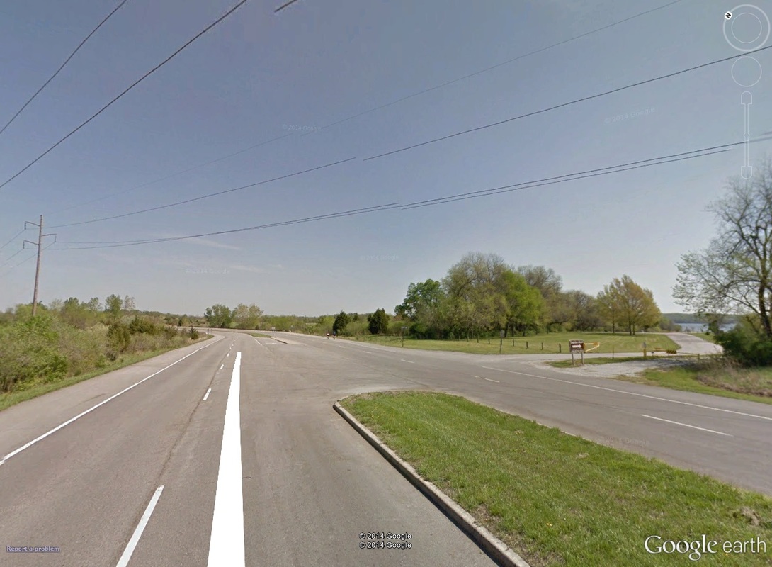 7.40mi: The northern run on Raytown Road, with Pittenger Road on the right. Stay to the left on Raytown Road, though! The Northern sections of Raytown Road tend to undulate a little bit, with uphills here and there, particularly before turning right on to 109th Street at mile 8.6. 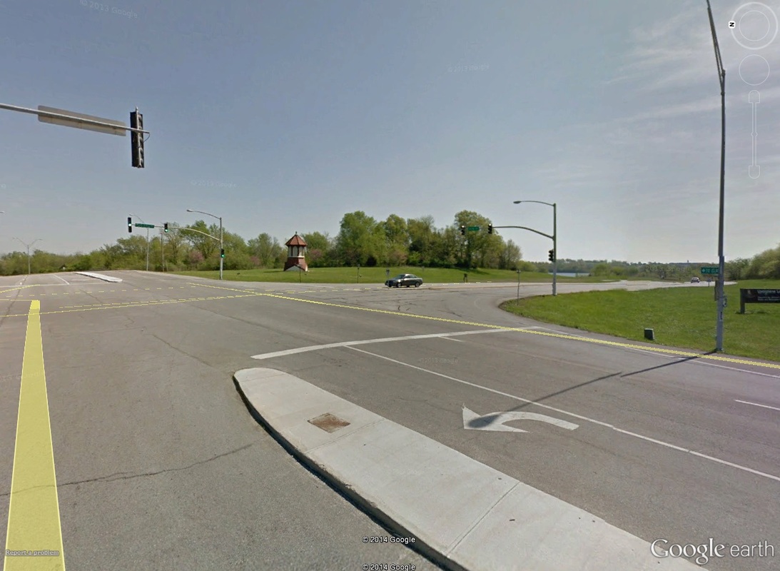 8.65mi: Look for the top of what looks like a lighthouse. That marks the next turn, this time in to the left-side lane of 109th Street heading East. 9.00mi to Finish: The scenery doesn't change much after the turn on to 109th Street. The 10-mile marker comes right at the turnaround back West on 109th Street. 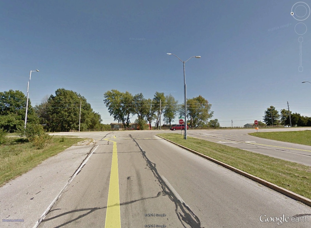 10.00mi: About where the 10-mile marker is, with the turnaround at stop sign, at the corner of 109th and View High Drive. Again keeping in the left-side lanes, the return along 109th Street followed by Raytown road is the same as the outbound trek. The only difference is you finally get to head back in to the park (and thus, finish line) on Pittenger Road. Coming off of Raytown on to Pittenger, runners have only a tenth of a mile to go.
That's all I got for now. I'll y'all out there! Keep R/B/S-ing. -tds ~~__o _-/<,_ @/ @
0 Comments
Your comment will be posted after it is approved.
Leave a Reply. |
